
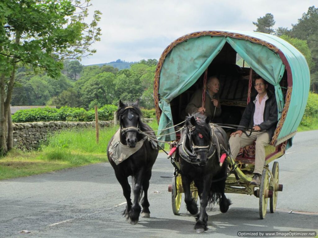
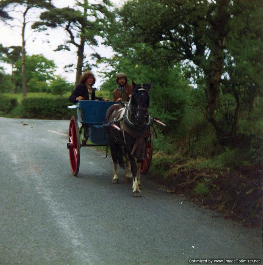
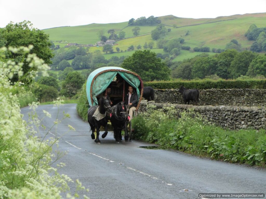
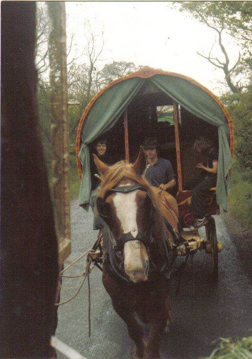
Rossendale to Appleby Fair, by road, in 1978
Note: this was written in 1978, and quite a bit has changed since then, with road-widening and development, but most of the stopping places are still there. A lot more areas fenced off around Sedbergh and Kirkby Stephen, so maybe check then out before you travel.
There are several possible roads North out of East Lancashire to Appleby fair, but the best is through Accrington to Clitheroe. This road goes through towns as far as Great Harwood with hardly any grazing, few stopping places and not much water. There are two bad hills – on the way North out of Accrington and up from Hyndburn Bridge to Great Harwood. There is some grazing on the Rawtenstall by-pass for about a dozen horses, beside the river, but the water is polluted. A wagon can be pulled on to the verge, but the police are likely to try to move you on. There is a stopping place close to Haslingden Auction with grazing for a few horses, but I have not tried it.
As you pass the traffic lights on the way up the hill into Haslingden, there is a garage on the left with a water tap outside the office – the people are friendly and will let you fill a can of water. It is possible to stop on a rough patch of land at Hyndburn Bridge, but this means a stiff pull out up the hill with a cold collar on one of the early stages of a journey before the horses have got into their work.
The first good grazing is on the Whalley by-pass. You can pull in on the left hand verge where you come to it and tie the horses to a post and rail fence, but there is no water close by. The woods are full of wild garlic.
A better place to pull in is a few hundred yards further on after the traffic lights to Whalley, but the flat verge is on the other side of the road. There is a low bridge taking a footpath under the toad from the Picnic Area to Whalley, and if you go through the bridge there is a stream in the woods that can be dammed up so that you can fill buckets. The woods, most of which are fenced off, have good ash and hazel rods. There is a glade just below the bridge that has good grazing of about half an acre. The woods, verges and picnic area belong to Lancashire County Council, and the warden points out that horses are not allowed. The Police also discourage stopping on the verges of the by-pass.
Further on at a roundabout the Whalley by-pass joins the Clitheroe by-pass. This has wide verges with good grazing but no water. The police try to turn horse-drawn vehicles off the by-pass on the grounds that they might cause an accident.
There is a good stopping place under the trees at Four Lane Ends, which turns off the by-pass towards Clitheroe. There is good grazing for about 12 horses in sight of the wagon, and for many more on verges out of sight. There is plenty of firewood under the trees and a good stream runs under the road 50 yards away. You have to take water from a pool at the side of the road in buckets. This lane goes on a few hundred yards between high hedges to rejoin the by-pass, which rises steadily, then drops down under a railway bridge towards a narrow lane where carts and wagons sometimes stop. From here there is a strong pull up to the Sawley turning.
2 mimes from Sawley you come to Copy Nook. This is a good stopping place, with grazing for about 20 horses, but it is very popular so you may find no grass there. Some of the grazing is shaded under the trees. The river flows under the road, and then along beside it and wild ducks nest here. You can fill buckets with a rope or lead the horses over the bridge and through a field gate to the water’s edge. 200 yards away is the Copy Nook inn, with Thwaites’s beer, and mile further on is the village of Bolton by Bowland that has a Post Office and general shop, and a Butcher. The Post Office sells bread and milk.
There are two roads from Copy Nook to Wigglesworth. The short one is about 6 miles with the worst hill of the whole journey at Forest Becks. The road dips steeply with a double bend over a bridge at the bottom and then a short but very steep hill with a curve up from the bridge, There is a lay-by at the top on the offside, where the horses can get their wind after the hill, but only room for a couple of carts. The farm at the bottom has a Land Rover and has often helped wagons in trouble. There is a telephone box by the bridge.
A mile on from Forest Becks there are some verges with a little grazing at Higher Flass. The lay-by that used to be a stopping place is now filled with piles of road chippings, and the wheelwright has moved from Higher Flass to Adams Farm at Paythorne a few miles away.
From Higher Flass the road rises steadily and then drops to Wigglesworth where there is a Post Office and shop, and the Plough Inn has a large forecourt where you can pull onto while you have a drink and rest the horses. The other road from Copy Nook goes through Bolton by Bowland village with a long steady pull up to ‘Pyecrust’ where you can stop, but the grazing is poor and there is no water. This road is a mile or two longer.
You turn left at The Plough to Rathmell, with a couple of sharp pulls and several good verges. There is water in two streams, but you have to use a bucket. Rathmell church has a clock in in the tower. Going out of the village there is a steep hill down onto the flat land in the valley bottom leading to Settle. The stopping place is close to a stone barn with good grazing on the verges for about 20, but a favorite stopping place so there may be no grass left. There is usually some firewood in the hedge bottoms. There is a big concrete water trough in the yard by the barn, but it is filled with rainwater so it may be empty or green. There is a gate on the other side of the road into a field. that has a little stream, and further on, the river. You need a bucket. The place is very exposed, and there are many curlews and oyster catchers.
The road goes on under a low bridge and turns left twice towards Lawkland, with a long hill that has two sharp pulls, the second being one of the worst of the whole journey, but this way avoids Buckshaw (Bucker) Brow on the main road, (a long steep hill with the worst right at the top when the horses are tired and cannot get into a trot, so best avoided.) The road goes on up and down to Lawkland and on up a sharp pull on a double bed out of the village and on and on to Cross Streets at the main road.
You can stop here overnight, there is grazing behind the pub half a mile further on the main road is a very good stopping place at Austwick Bridge, where a new bridge has been built and the old one with a length of road has been gated off as a lay-by. There is grazing for about a dozen horses, which can be led to the water, and there is usually driftwood on the riverbank. There is shelter beside and under the bridge. Across the side road to Austwick village, where there is an Inn and a shop, is another gated lay-by where horses can be turned loose, but there is not very much grass.
Clapham By-pass has wide verges with good grazing, that are mowed for hay by local farmers. Halfway along the bypass at a cross roads is a bridge with gates leading down to water where horses can drink. The village with shops and pub is ½ mile away.
Clapham common is a mile or so further on with extensive grazing. Wagons usually stop opposite the ‘Little Chef’ cafe, while trailers usually stop at the far end, where there is also good grazing. The road passes close to the village of Ingleton, where there are shops, and through Cowan Bridge which has a general shop at the roadside. There is a sharp pull between these two villages. This road is mostly fairly fast, and you must take care as you go down to the Whoop Hall Inn where there is a sharp bend. There is room here to pull in beside the pub to give the horses a rest. The road then drops down to Devils Bridge, where there is a one way road leading back from the Sedbergh Road.
You can stop under the trees and there is grazing on the verges of the main road. There is a tea and snack bar beside the bridge, and a stile leads sown to the water where you can fill buckets. Then North from Devil’s Bridge towards Sedbergh you near Casterton there is a short verge on a bend close to a golf club; there is room to graze about 6 horses, for a short stop, but no water. Casterton Church has a clock on the tower. Further up the road there is a sharp pull uphill past a farm, and there is a good stopping place known as 19 trees in a side lane, but the water supply may be dry. There is also a verge with a little grazing as you drop down to Middleton Church.
Brackens is a traditional stopping place on a piece of common that stretches up the hill, with a narrow tarmac road winding through it to the farm at the top. Carts and wagons usually pull on right at the bottom or else go up the lane about 50 yards, while trailers mostly go to a green lane halfway up. Just above this there is a small stream where you can water the horses. Many people turn their horses loose, some leaving a trailing rope, but stallions and some of the more difficult to catch are kept tethered. There are a lot of bushes and tethered horses can get tangled in these. There is also water in the River lune which can be reached through the woods below the old railway bridge. The woods are birch sycamore, hazel, ash, and willow.
The Railway Inn is a hundred yards or so from the common land, and travellers are welcome, but Cumbria County Council have imposed restrictions on stopping at Brackens since the Boswells’ overstayed their welcome a year or so ago. Camping is now permitted only for 3 days before and after Appleby.
About half a mile through Sedbergh are the well know verges, and there are usually dozens of trailers and horsedrawn turnouts camped there, on both sides of the road. Water comes from a field trough, by permission of the farmer. There is a wide verge just past the bridge with good grazing, and a few hundred yards up Haunted House – one of the best camps on the road and often has a big campfire. This is a favourite spot of the Blackpool cab-men, and you will usually find a friendly greeting – but watch out for the dogs. (Note: 25 years later in 2021, the verges are now closed for stopping, but the nearby Scroggs Bank field is open before and after the Fair, with rubbish skips, water bowser and toilets provided.)
There is a good wide layby at Cautley, with room for half a dozen horses for a few hours, and the river beside you, but you have to climb down with a bucket to get water. Further up there is a large open area on the left, with room for a lot more, but it is not far from there to Fell End, so most people just push on.
There is room for hundreds at Fell End, although camping is limited to a few days before and after the fair. The Fat Lamb is a great singing pub and does good food and good beer. Half a mile further on is Scandale Beck, over the cattle grid and onto the common. Plenty of space, and plenty of water, but the sheep graze all year round so the grass is usually short.
There a few places to pull off the road on the fell, before you start the steep descent into Kirkby Stephen. Almost at the bottom of the hill before you cross the bridge by the old station yard is a layby, and beside it a single track road goes up to the right, where there are some verges just wide enough to camp. Kirkby Stephen has a co-op, a pub and a chippy, with a good butcher and a baker.
Past Kirkby, the shortest route is via Warcop, although there are a lot of trailers stop on the wider verges between Kirkby Stephen and Brough. At Warcop there is a village green although the residents are not keen on campers due to some bad behaviour in the past., There are one or two good lanes on the outskirts, and a few miles further on is Sandford Common and the verges by Sandford Road End. These are the last good stopping places before you trot down the A666 for the the final pull in to Appleby town.
Walter and Bill Lloyd
20th June 1978